Wolfberg Arch
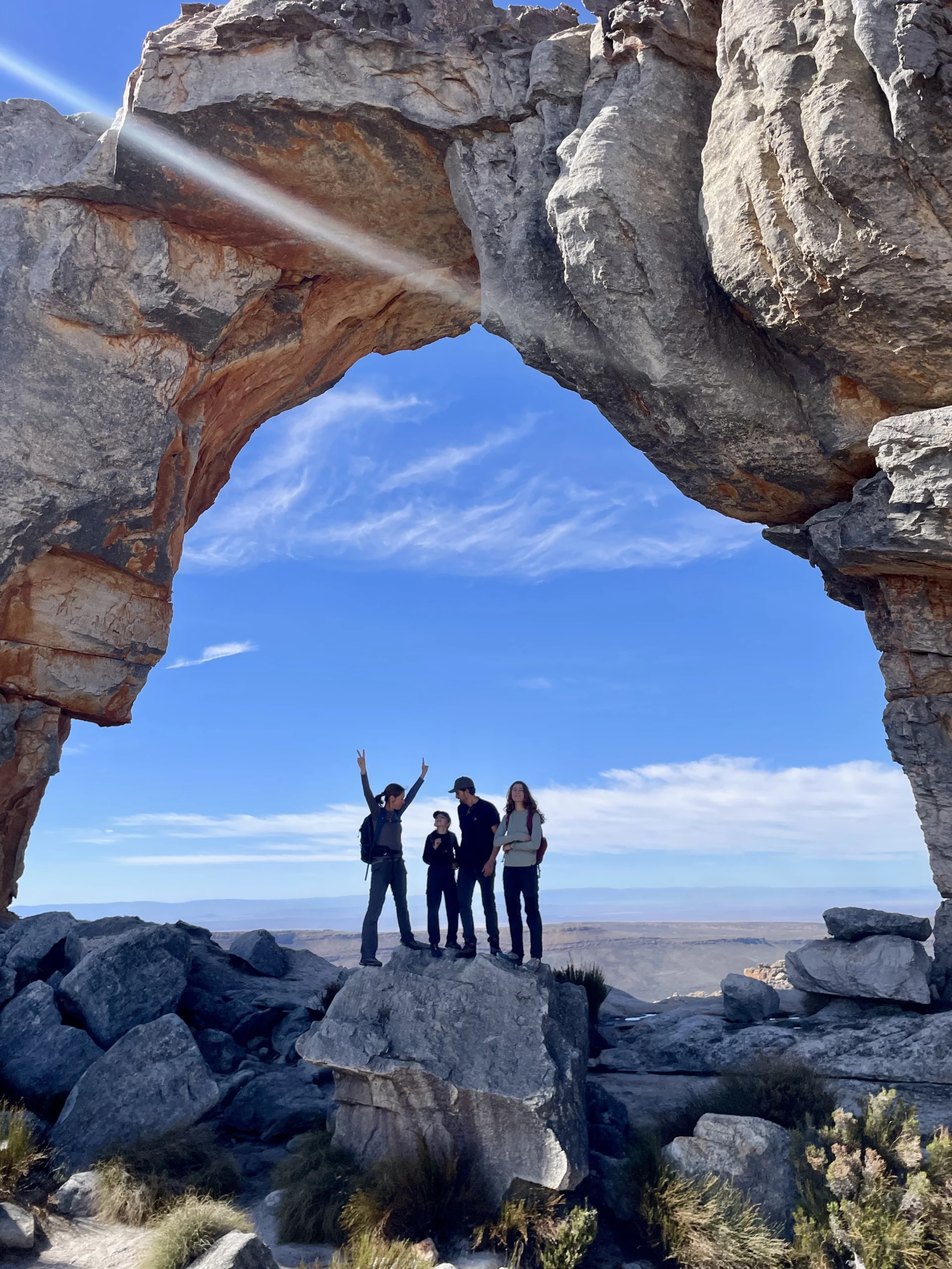
A full-day hike in the Cederberg Wilderness Area to one of South Africa’s most iconic sandstone formations. Expect steep early climbing, exposed ridgelines, and wide-open viewpoints near the arch.
Quick facts
Published route figures vary depending on the exact approach and whether you combine the route with the Wolfberg Cracks section. The ranges below reflect typical day-hike figures for the Arch route.
Overview
What makes it special
- The arch: a massive natural sandstone window and the hike’s main objective.
- Ridgelines: open Cederberg views and big geological “wave” formations.
- Classic terrain: steep early ascent, then more rolling rock-and-sandstone travel.
Who it suits
- Hikers with solid fitness who are comfortable with a full-day outing.
- People who can handle steep uphill sections early on (and the same downhill later).
- Anyone wanting a true Cederberg “signature” landmark hike.
What “moderate–strenuous” means here
- Distance + time commitment (6–8 hours is common).
- Steep ascent out of the gate (many guides call this the hardest part).
- Uneven rock, sandy patches on rock, and wind exposure near the top.
Route outline
Typical day-hike flow
- Start: begin from the commonly used Wolfberg access/parking areas (confirm at permit issue point).
- Early climb: steep ascent up onto the higher ground (expect sustained effort).
- Traverse: follow the main trail across sandstone terrain with viewpoint stops.
- Arch approach: the arch becomes visible ahead; final approach includes short up/down undulations.
- Arch time: photos + a break; allow time to explore viewpoints safely.
- Return: retrace your route; the descent can be slow on tired legs.
Common variations (why numbers differ)
- Arch only vs. Arch + Cracks: adding the Cracks route typically increases time and can affect distance totals.
- Different access points: Sanddrif/Dwarsrivier vs. Driehoek/Keurbosfontein approaches can change the distance/elevation profile.
- Exploration time: lingering in scenic zones can easily add 30–90 minutes (or more).
Permits & access
Day hiking permits
Day hiking permits for Wolfberg Arch are issued via specific CapeNature-linked points. CapeNature lists these as:
- Sanddrif
- Driehoek
- Keurbosfontein
Because access and route choice affect distance/time, confirm your intended route at the point where you collect your permit.
Getting there (high level)
- Region: Cederberg Wilderness Area (CapeNature-managed area).
- Common base areas: the Sanddrif/Dwarsrivier side is frequently referenced as a starting area for Wolfberg hikes.
- Road reality: expect gravel sections depending on your access point—drive time can be longer than map apps suggest.
Timing & seasons
Best time of year
- Cooler months: generally more comfortable for long exposed hiking.
- Hot months: heat + exposure can significantly increase difficulty; start early.
- Wind: ridges can be windy year-round; pack a light layer even on warm days.
How long to budget
- Standard day hike: commonly described as ~6–8 hours.
- Photo-heavy / slow pace: add buffer time.
- Short daylight: in winter, be conservative with timing.
Closures & conditions
- Sections of the Cederberg can close due to wildfire activity or high fire danger.
- Weather changes quickly—check forecasts and local updates before committing.
What to bring
Essentials
- Enough water for a full-day hike (don’t assume water on route).
- Sun protection: hat + sunscreen.
- Wind/rain layer (lightweight).
- Food/snacks: lunch + extra energy snacks.
- Charged phone + basic navigation plan (offline map recommended).
Footwear & comfort
- Trail shoes with good grip (sand on rock can be slippery).
- Plasters/tape for hot spots (long descents punish feet).
- Optional: trekking poles (useful on steep descent).
Safety
Before you go
- Confirm permit and access point requirements.
- Check weather (heat + wind exposure matters here).
- Tell someone your plan and expected return time.
- Start early if temperatures are high or daylight is short.
On the trail
- Keep a steady pace—this is a long hike, not a sprint.
- Be careful on smooth rock with sand (especially descending).
- If conditions worsen (heat, wind, visibility), turn back early.
FAQ
Is it suitable for beginners?
It’s better described as a full-day hike that suits reasonably fit hikers. The steep early climb and long distance are the main barriers.
Why do distances differ online?
Different access points, GPS drift in sandstone corridors, and whether you include the Cracks section can all change recorded totals.
Do I need a permit?
Yes—CapeNature lists day hiking permits for Wolfberg Arch from Sanddrif, Driehoek, and Keurbosfontein. Always confirm current rules at your access point.
How much time should I plan at the arch?
Budget a proper break. Many groups spend 30–60 minutes taking photos and resting, which affects total time.
Accuracy policy: This page uses typical published ranges for distance/time and labels route-dependent items clearly. Final numbers depend on the access point used and whether the route includes the Wolfberg Cracks section. Confirm route and permit details locally before you start.